What did the 1890 establishment of Sequoia National Park protect?
The 1890 establishment of Sequoia National Park secured 404,064 acres of forested terrain in the southern Sierra Nevada, preserving Mount Whitney and the Giant Forest.

Pre-Settlement Homelands
Before Euro-American settlement, the landscape now known as Sequoia National Park served as the ancestral homeland for five distinct tribes. These groups included the Monache, also known as Western Mono, and the Tubatulabal. The Owens Valley Paiute, the Yokuts, and the Shoshone, referred to as Newe, also held deep ties to this region. The park preserves a landscape that was central to their lives long before federal protection was considered. This historical depth underscores that the land was not empty wilderness but a lived-in environment with established cultural and ecological relationships that predated any government boundary.
The establishment of the park in 1890 did not erase these historical connections but rather formalized the protection of the land itself. The terrain, located in the southern Sierra Nevada east of Visalia, California, remained a place of cultural significance. The specific tribal names listed in the records highlight the diversity of the indigenous presence. This context is essential for understanding the full scope of what the 1890 congressional act preserved beyond just trees and mountains. Recognizing these prior inhabitants provides a necessary framework for interpreting the park’s origins and its ongoing role in preserving both natural and cultural heritage.
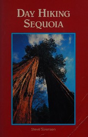 Day hiking Sequoia
Steve Sorensen · 1991
Day hiking Sequoia
Steve Sorensen · 1991
Defining the Protected Terrain
The 1890 act defined a massive protected area of 404,064 acres of forested mountainous terrain. This figure is precise and remains the standard measurement for the park's size today. The land is situated in the southern Sierra Nevada, east of the town of Visalia. The protection extended across a dramatic vertical range, encompassing nearly 13,000 feet of elevation change. This relief includes the highest point in the contiguous United States, Mount Whitney, which stands at 14,505 feet above sea level. The sheer scale of this elevation difference meant that the protected zone contained a wide array of climatic and biological conditions within a single administrative boundary.
The inclusion of such extreme vertical relief meant the park protected a wide variety of ecosystems. From the lower foothills to the high alpine zones, the terrain varied significantly. The specific mention of Mount Whitney in the records underscores the geographic significance of the protected area. By securing this vertical span, Congress ensured that the full range of the Sierra Nevada's ecological and geological features within this specific boundary remained under federal stewardship. This comprehensive approach to protection recognized that the mountain range’s integrity depended on preserving its entire vertical profile, from valley floor to summit.
The Giant Forest and Old-Growth
A primary focus of the protection was the giant sequoia forests, particularly the Giant Forest. This area contains the General Sherman Tree, recognized as the largest tree on Earth by volume. The Giant Forest is not an isolated stand; it contains five of the ten largest trees in the world. These massive trees are part of a larger system of old-growth forests that spans 202,430 acres. This old-growth area is shared between Sequoia and Kings Canyon National Parks, highlighting the interconnected nature of the protected lands. The concentration of such monumental trees in a single region made this area a unique global resource that required specific legislative attention to ensure its long-term survival.
The preservation of these old-growth forests was a critical component of the 1890 establishment. The sheer size of the sequoias, including the General Sherman Tree, made them unique global assets. The connection to Kings Canyon National Park, which is contiguous and south of Sequoia, further emphasized the scale of the protected ecosystem. The Generals Highway now links the Giant Forest to the General Grant Grove in Kings Canyon, facilitating access to these significant natural landmarks. This physical and administrative linkage reinforces the idea that the protection of these ancient trees is a regional effort, spanning multiple park boundaries to maintain ecological continuity.
Administrative and International Recognition
Following its establishment, Sequoia National Park was administered by the National Park Service. Due to its proximity and contiguous nature, it is managed together with Kings Canyon National Parks. This joint administration allows for coordinated stewardship of the shared old-growth forests and wildlife habitats. The administrative structure has remained consistent, ensuring that the 404,064 acres are protected under a unified management plan. This approach leverages the geographic continuity of the two parks for effective conservation. By treating the adjacent areas as a single unit for management purposes, the National Park Service can address ecological challenges that cross park boundaries more efficiently.
This international recognition highlighted the region's extensive old-growth forests and ecological importance. The 1976 designation built upon the foundational protection established in 1890, acknowledging the park’s value on a worldwide scale. The records confirm that the park continues to protect the specific acreage and features defined at its inception. This enduring commitment to preservation ensures that the unique ecological and geological features of the southern Sierra Nevada remain intact for future generations.
Timeline: The United States Congress establishes Sequoia National Park
- September 25, 1890 U.S. Congress establishes Sequoia National Park
- 1922 Last California grizzly killed in the park
- 1965 Forest Service issues prospectus for Mineral King ski resort
- 1966 Walt Disney dies
- 1976 UNESCO designates Sequoia-Kings Canyon Biosphere Reserve