
People in this story


Explore this event
 The wider storyHow did the 1816 Treaty of St. Louis clear the land for Chicago’s canals?Signed at Portage des Sioux in 1816, the Treaty of St. Louis transferred a 20-mile land corridor from the Council of Three Fires to the United States. This specific cession, negotiated by William Clark and others…Read the full history
 Key facts about the Treaty of St. Louis
| Event | Treaty of St. Louis signed by US and Council of Three Fires |
|---|---|
| Date | August 24, 1816 |
| Location | Portage des Sioux, Missouri, located immediately north of St. Louis. |
| Key Figure | Ninian Edwards, William Clark, and Auguste Chouteau signed for the United States. |
| Source Detail | The treaty was proclaimed on December 30, 1816, following the initial signing date. |
| Confirmed Outcome | Tribes relinquished land titles previously ceded by Sac and Fox tribes in 1804. |


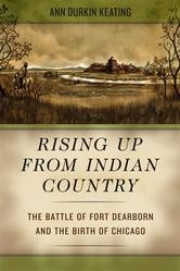


First Reports From the Scene

The Chicago Historical Society authenticated the plaque. Erected in 1937 by the Chicago Charter Jubilee, it stands at the intersection of North Rogers Avenue and North Clark Street. The marker sits on the south-facing side of the building at 7407 North Clark Street. It commemorates the cession of land including the Chicago site.
Rogers Avenue in Rogers Park and Forest Preserve Drive on the northwest side align with the northern border. Short Indian Boundary Roads in River Grove and Melrose Park mark the same path. Indian Boundary Line Road in Plainfield follows the southern border. These diagonal routes north and west of Chicago reflect the original land cession.
Timeline: the road to this event and its aftermath
- November 3, 1804 Sac and Fox tribes cede land to the United States
- August 24, 1816 Ninian Edwards, William Clark, and Auguste Chouteau sign the Treaty of St. Louis with the Council of Three Fires
- December 30, 1816 Federal government proclaims the treaty
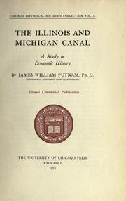
- 1848 Engineers build the Illinois and Michigan Canal on the ceded land
- 1937 Chicago Charter Jubilee erects the Indian Boundary Lines Historical Marker
Rescue, Response, and Fallout

This date marked the legal finalization of the agreement between the United States and the Council of Three Fires. The legal transfer of title was complete upon proclamation.
Modern roads trace the treaty lines.
The agreement was signed at Portage des Sioux, Missouri.
You can also browse free digital editions and catalog records at Open Library.
Analysis: Treaty of St. Louis (1816)
What the evidence supports and leaves unresolved
What the record supports
- Precise Location Clarification: In the Treaty of St. Louis (1816) source record, the signing occurred at Portage des Sioux, Missouri, a location immediately north of St. Louis. This specific place name anchors the diplomatic event to a precise coordinate in the landscape, correcting the geographical assumption implied by the treaty's title.
- Detailed Signatory Identification: The historical record names Ninian Edwards, William Clark, and Auguste Chouteau as the specific representatives for the United States. It also identifies the Council of Three Fires, comprising the Ottawa, Ojibwa, and Potawatomi tribes, as the indigenous signatories. This level of detail ensures that the diplomatic actors are clearly identified rather than referred to generically.
- Specific Land Cession Terms: The source documents the exact nature of the land transfer, specifying a twenty-mile strip connecting Lake Michigan with the Illinois River. It further details that this land was later used for the Illinois and Michigan Canal in 1848. The record also notes the financial compensation of one thousand dollars in merchandise over twelve years. These concrete figures and descriptions provide a clear picture of the transaction's scope and the specific territorial changes enacted by the treaty.
Limits and unresolved questions
- Limited Compensation Context: In the Treaty of St. Louis (1816) source record, the source states that the tribes were to be paid one thousand dollars in merchandise over twelve years for the ceded land. However, it does not provide context regarding the perceived value of this compensation relative to the land's worth or the tribes' economic needs. The record lacks information on whether this amount was considered fair by the signatories or if it reflected broader federal policies of the era. This absence leaves the economic impact on the indigenous communities largely unexplained.
- Ambiguous Tribal Consent Process: While the source lists the tribes involved, it does not describe the internal decision-making processes within the Council of Three Fires. There is no information provided about how the representatives were selected or whether all factions within the Ottawa, Ojibwa, and Potawatomi communities agreed to the terms. The record treats the signing as a unified action without detailing any dissent or negotiation dynamics that may have occurred among the indigenous leaders prior to August 24, 1816.
- Lack of Immediate Aftermath Details: The record notes the proclamation date of December 30, 1816, but offers no details on the immediate reactions of the tribes or the federal government following the signing. It does not describe any enforcement actions, disputes, or celebrations that occurred in the months between the signing and the proclamation. This gap leaves the immediate social and political consequences of the treaty's execution undocumented.
What strikes us about this is the sheer arithmetic of the exchange. The Council of Three Fires surrendered a twenty-mile strip of land connecting Lake Michigan to the Illinois River for exactly one thousand dollars in merchandise, paid out over twelve years. It was a transaction that prioritized the logistical convenience of the Illinois and Michigan Canal over the sovereignty of the Ottawa, Ojibwa, and Potawatomi. We see how the federal government used the pen to redraw the map, turning ancestral territory into a commodity for War of 1812 volunteers. The roads that now trace these boundaries—Rogers Avenue, Indian Boundary Line Road—are not just infrastructure; they are the physical scars of a legal fiction that called itself progress. As we navigate the city in 2026, we drive over the very lines that erased a people, mistaking the pavement for neutral ground. History is not just in the archives; it is under our tires.
Evidence Map: How We Checked the Central Claim
What the sources verify and how they were used
This comparison separates the event page selected for the account from the independently verified page used to corroborate it.
Central claim checked: The Treaty of St. Louis is signed in St. Louis, Missouri.
| Direct source | Verification role | Coverage |
|---|---|---|
| Treaty of St. Louis (1816) · Wikipedia Accessed 2026-08-24 | Selected event record | Supports the central claim shown above. |
| Indian Boundary Lines Historical Marker · hmdb.org Accessed 2026-08-24 | Independent corroboration | Supports the central claim shown above. |
You Might Also Like


What was the Treaty of St. Louis?
The lead-up included Sac and Fox tribes cede land to the United States.

Key figures included Ninian Edwards, William Clark, Auguste Chouteau.
In the aftermath: Federal government proclaims the treaty; Engineers build the Illinois and Michigan Canal on the ceded land; Chicago Charter Jubilee erects the Indian Boundary Lines Historical Marker.
In the Treaty of St. Louis (1816) source record, the signing occurred at Portage des Sioux, Missouri, a location immediately north of St. Louis.