SignificanceFirst satellite in the Landsat Earth observation program
LegacyA repeatable digital record of Earth's land surface
Did You Know?
Did you know
Landsat 1 launched as ERTS 1, short for Earth Resources Technology Satellite 1. NASA announced the Landsat name on January 14, 1975, eight days before the launch planned for ERTS B, which became Landsat 2.
Did you know
In 1976, Landsat 1 imagery identified a tiny uninhabited island off Canada's eastern coast. The official mission record identifies the location as Landsat Island and places it about 20 kilometers from the coast in the Atlantic Ocean.
Did you know
At its 1972 launch, Landsat 1 carried two wide band video tape recorders, each able to store about 30 minutes of scanner or camera data. The recorders held observations when the spacecraft was beyond a receiving station and transmitted them during a later contact.
Did you know
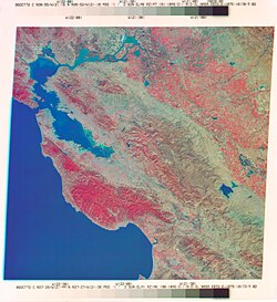
The United States Geological Survey displays a Landsat 1 image of Dallas and Fort Worth received on July 25, 1972. In the false color scene, vegetation appears in red shades while urban or rocky areas appear gray and white.
Did you know
NASA reports that the Landsat 1 Multispectral Scanner collected more than 175,000 scenes during five and a half years in orbit. Each scene covered roughly 170 by 185 kilometers, while the instrument recorded four bands at about 80 meter resolution.
The Journey and the Stakes
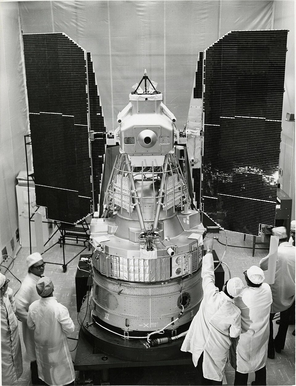
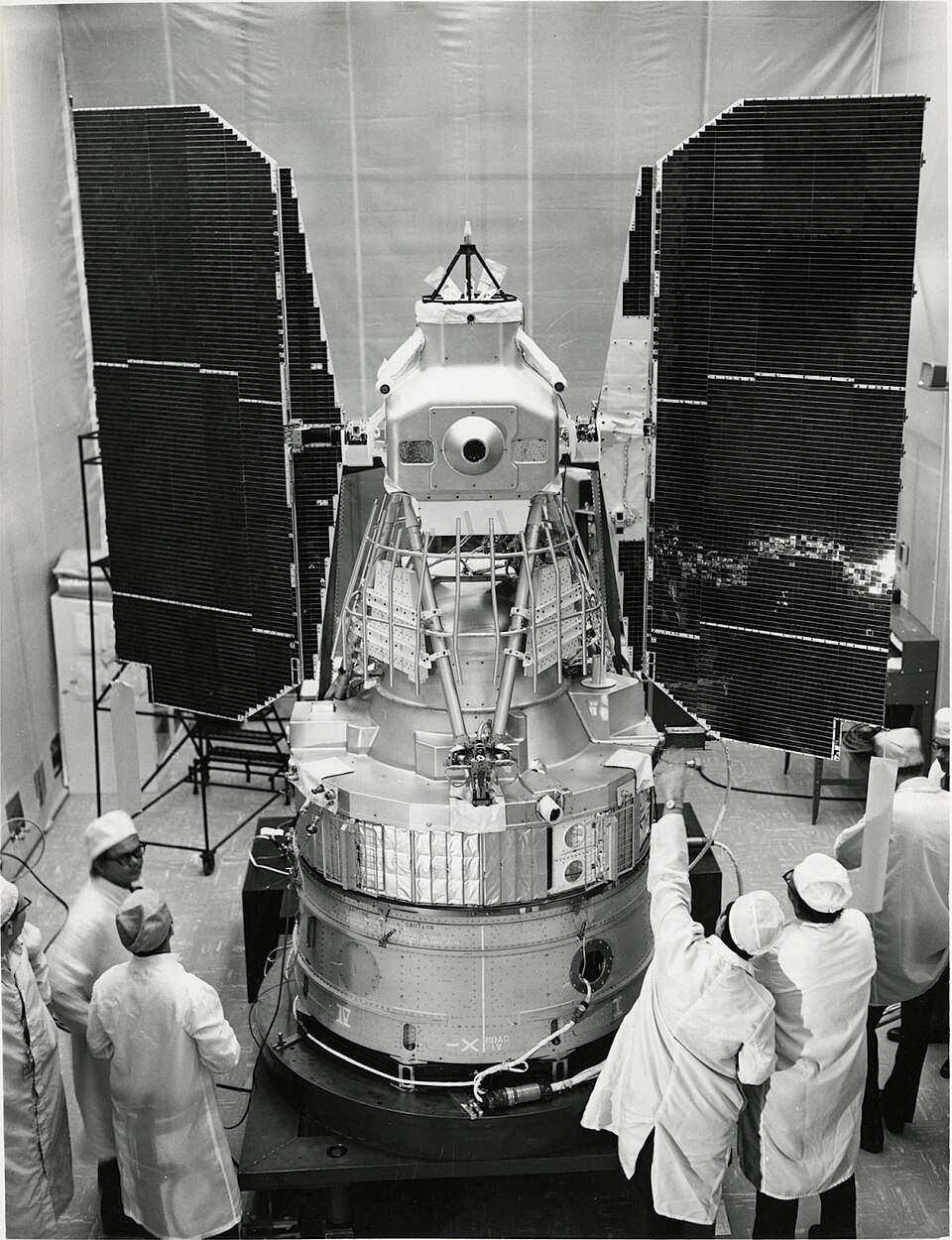
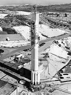
A Delta rocket lifted the Earth Resources Technology Satellite from Vandenberg Air Force Base on July 23, 1972. NASA and the United States Geological Survey wanted a spacecraft that would look down at land, water, forests, farms, and cities on a regular schedule. Once in orbit, ERTS 1 became the first satellite in what would later be called the Landsat program. Its task was not to make a single dramatic photograph. It was built to return comparable measurements over and over, giving researchers a consistent record of the planet rather than an occasional view from a crewed spacecraft or weather satellite. NASA's mission record describes an experimental program whose observations were evaluated by scientific and government users.
Landsat 1 carried two very different imaging systems. The Return Beam Vidicon used technology related to television camera tubes and was expected to be the main instrument. Beside it sat the experimental Multispectral Scanner System, designed by engineer Virginia Norwood and her team at Hughes Aircraft Company. The scanner measured reflected energy in four spectral bands, including two near infrared bands, while an oscillating mirror swept across the ground below. The spacecraft's forward motion supplied the next lines of the image. That method converted the surface into digital measurements that could be compared, mapped, and analyzed. It was less familiar than a camera, but it soon became the mission's defining instrument.
Evidence Map: How We Checked the Central Claim
What the sources verify and how they were used
This comparison separates the event page selected for the account from the independently verified page used to corroborate it.
Central claim checked: The United States launched Landsat 1 on July 23, 1972, as the first satellite in the Landsat program.
NASA records the July 23, 1972 launch as the beginning of the Landsat Earth observation program. NASA identifies Virginia Norwood as the designer of the first space based multispectral scanner flown on Landsat 1.
USGS records Landsat 1's July 23, 1972 launch from Vandenberg Air Force Base and its January 6, 1978 decommissioning. USGS reports that Landsat 1 imaged about 75 percent of Earth's surface and captured a large Alaska fire within days of launch.
Claims are paraphrased for comparison; use the direct source links for the full record.
NASA's mission record describes a rapid shift between the two instruments during the first days in orbit. The first images reached Goddard Space Flight Center two days after launch, and the scanner data impressed the scientists and engineers examining it. The Return Beam Vidicon then suffered an electrical problem. Operators shut it down while the Multispectral Scanner continued to perform well. The experimental instrument became the primary source of imagery. Landsat 1 returned digital multispectral measurements across a broad strip of land, and the official record identifies the MSS as the mission's successful imaging system.
The orbit made those observations systematic. Landsat 1 traveled in a near polar, sun synchronous path about 917 kilometers above Earth. It completed an orbit in roughly 103 minutes, about fourteen times each day, while its pattern brought it back over the same ground every 18 days. The scanner observed a swath about 185 kilometers wide with roughly 80 meter ground resolution. Four spectral bands separated green, red, and near infrared energy. Vegetation, water, burned land, exposed rock, and built areas reflected those bands differently. Researchers could therefore examine properties that an ordinary color photograph did not isolate, while the repeat cycle allowed a later scene to be compared with an earlier one.
Watch on YouTube
Find documentaries and videos about: The United States launches Landsat 1
Useful results appeared almost immediately. USGS reports that Landsat 1 recorded an 81,000 acre fire in central Alaska while it was still burning. One image showed the full extent of a remote event that was difficult to view from the ground. The mission also supplied scenes for agriculture, forestry, geology, hydrology, mapping, and coastal study. NASA organized a principal investigators program involving about 300 researchers, with participants from outside the United States as well as domestic agencies and universities. The aim was practical evaluation: test what the new measurements could reveal, determine how reliably they could be interpreted, and establish where repeated orbital coverage added information that aircraft surveys or conventional maps could not provide.
The spacecraft lasted far beyond its planned one year. Landsat 1 continued operating until January 6, 1978, and its images covered about 75 percent of Earth's surface. The mission produced a large archive rather than a handful of showcase pictures. Its scanner data supported early work with vegetation measurements and showed how four spectral bands distinguished features that looked similar in visible light. International ground stations and research partnerships expanded access to the observations. On January 14, 1975, NASA announced that ERTS 1 would be called Landsat 1 and ERTS B would be called Landsat 2 after launch. The experimental program now had a name tied directly to observation of land.
The Boundary It Moved
The central technical result on Landsat 1 came from Virginia Norwood's Multispectral Scanner. The familiar Return Beam Vidicon did not remain dominant, while the scanner delivered the measurements that researchers preferred. The spacecraft operated with a repeatable 18 day orbit pattern, a 185 kilometer ground swath, four spectral bands, and digital processing. A forest, river basin, farm region, city edge, or burn scar appeared within the same measurement framework. The NASA and USGS records emphasize that consistency across scenes. A later pass could be compared with an earlier pass, and separate places could be examined with the same 80 meter scanner system.
The July 23, 1972 launch opened an operating record rather than producing only one set of pictures. Landsat 1 was taken out of service on January 6, 1978. By that date, Landsat 2 and Landsat 3 were part of the named program, and the archive held repeated observations from the first mission. NASA developed and operated the space systems, while USGS stored, processed, and distributed land data. The original satellite was modest by later standards, with 80 meter imagery and four scanner bands. Its official mission record nevertheless documents a complete working method: Earth observations collected from a regular orbit, processed as digital measurements, and retained for scientific and public use.
Analysis: Landsat 1
What the evidence supports and leaves unresolved
The overview above gives the factual narrative. This optional section separates interpretation from the documented record.
What the record supports
Repeatable observation: USGS lists an 18 day repeat cycle and NASA lists a 103 minute orbit for Landsat 1. Those fixed intervals supplied researchers with multiple observations of the same region under a documented orbital pattern. The archive supported comparisons across dates rather than relying on one isolated photograph, while the 185 kilometer swath provided regional context for each scene.
Digital spectral evidence: Virginia Norwood's Multispectral Scanner recorded four bands at about 80 meter resolution. Two bands measured visible light and two measured near infrared energy. NASA's mission record reports that this digital scanner outperformed the planned Return Beam Vidicon, so analysts received distinct measurements for vegetation, water, rock, burned land, and built areas instead of a conventional color view.
Broad public research use: NASA organized a principal investigators program with about 300 researchers, and USGS records that roughly one third came from outside the United States. The Landsat 1 archive was examined for agriculture, forestry, geology, hydrology, cartography, coastal study, and other public uses. That breadth tested one instrument against many practical questions instead of treating its imagery only as a technical demonstration.
Limits and unresolved questions
Coarse ground detail: The United States Geological Survey and NASA specify roughly 80 meter ground resolution for the Landsat 1 scanner. A measurement cell of that scale described regional patterns but did not resolve individual houses, small field features, or narrow infrastructure with the detail available from later satellites. The first mission's strength was consistent wide area coverage, and that choice placed a clear limit on local interpretation.
Instrument vulnerability: The Return Beam Vidicon suffered an electrical problem shortly after the July 1972 launch. USGS records that operators shut the RBV down to protect Landsat 1, while the experimental Multispectral Scanner remained in use. The mission lost its planned primary camera early and depended on a secondary instrument whose performance had looked less certain before orbital data arrived.
Incomplete global coverage: USGS estimates that Landsat 1 acquired images covering about 75 percent of Earth's surface during more than five years of operation. That is extensive but incomplete, and cloud cover could further limit what a particular scene revealed. The January 1978 archive was not a seamless view of every location; it was a large set of repeated swaths collected under real orbital and atmospheric constraints.
Our reading of the official record centers on the reversal aboard Landsat 1 after July 23, 1972. NASA expected the Return Beam Vidicon to be the main instrument, but an electrical problem removed it from service and Virginia Norwood's experimental Multispectral Scanner supplied the preferred data. The 80 meter scanner, 185 kilometer swath, and 18 day repeat cycle deserve to be read together. They describe a system built for consistent measurement across places and dates, not for one spectacular photograph. That practical combination is the clearest reason the first mission belongs in the history of public Earth observation.
The lead-up included The Department of the Interior begins the Earth Resources Satellites Program..
Key figures included Virginia Norwood.
In the aftermath: The first orbital images reach NASA, including a scanner view of the Dallas and Fort Worth area.; NASA announces that ERTS 1 will be renamed Landsat 1.; Landsat 1 is taken out of service after more than five years..
First satellite in the Landsat Earth observation program
About this article
AI assisted with source research and drafting. Before publication, automated safeguards checked direct citations, independent corroboration of the central claim, factual consistency, and required article structure. A human editor does not necessarily review every article before publication, so errors may remain. Read our editorial process.
The direct historical sources used for the central event are listed above.
Images via Wikimedia Commons.
Found an error? Let us know.
Advertisement
Advertisement
Test Your Knowledge
Based on the article you just read — 5 questions, under a minute.
0 of 5 answered
History runs on facts, and this project runs on coffee!
Your support is incredibly helpful and genuinely appreciated.